By Pandora Nash-Karner
We live in the “Middle Kingdom,” the fairytale name chosen by National Geographic to pinpoint the area on a map (between the Southern California of L.A. and San Francisco in the north). One of the best ways to experience our area, is by hiking on the innumerable miles of trails past subtle beauties, from mountaintops to remote beaches. Hiking is a huge part of life in San Luis Obispo County.
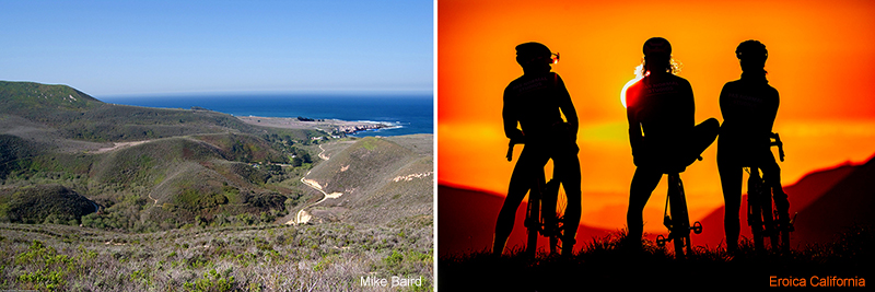
One of the best local hiking and mountain biking spots anywhere is Montaña de Oro State Park, just minutes from the Green Cottage.
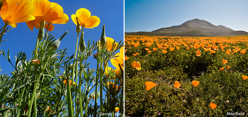
The park’s name, Montaña de Oro translates to “Mountain of Gold,” and comes from the golden wildflowers that bloom in spring. Wildlife in the park includes black tailed deer and the black oystercatcher. Be aware there are rattlesnakes here also.
Montaña de Oro is 8,000 acres, seven miles of uncrowded shoreline, sandy beaches, coastal plains, streams, canyons, and hills, including the 1,347-foot Valencia Peak. The park has many hiking, mountain biking, equestrian trails, a horse camp and an interesting museum at Spooners Cove.
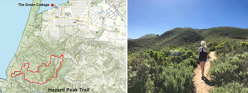
From the Cottage take Pine Street to Los Osos Valley Road, turn right. It turns into Pecho Valley Road and begins to parallel the ocean. As you approach the State Park the road becomes narrow and winding. Park at Hazard Peak Trailhead (parking area is on the right). If that lot is full, park at Spooner’s Cove about .25 miles further west.
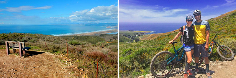
Picturesque views and well-maintained trails make this Park a hiker’s dream and a mountain biker’s paradise. Depending on the trail, a full suspension bike is best (but not necessarily essential) for most. Note that hikers and bikers share trails; bikers should use a bell for the safety of everyone on the trail.
The trail is a winding singletrack summiting Hazard Peak with great views all along the way. Hazard Peak Trail starts from Pecho Valley Road just north of Spooner’s Cove.
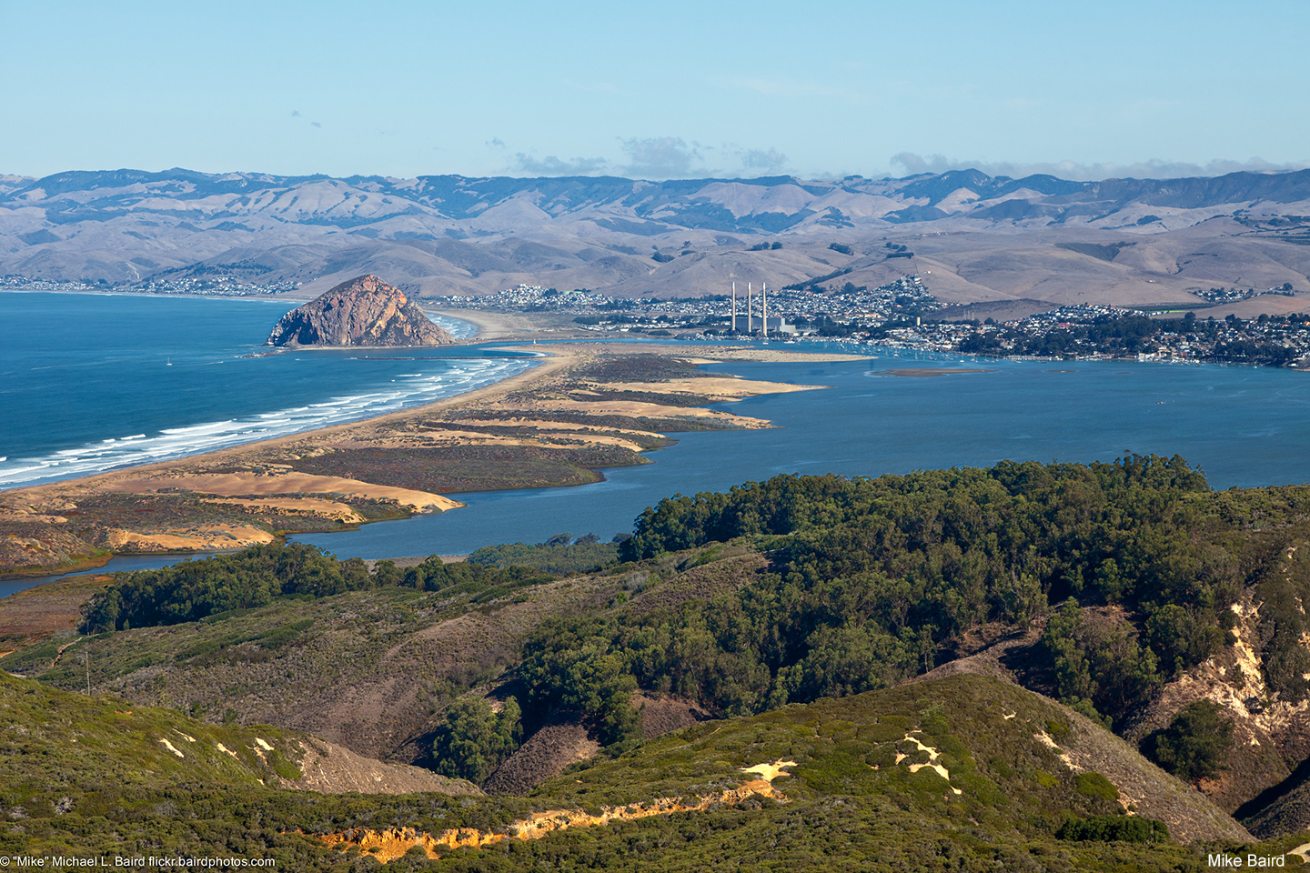
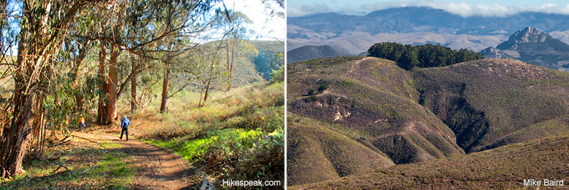
Despite the ominous name (Hazard Peak was named after a previous landowner, Alexander Hazard), the trail is a quiet and relaxing hike with stunning views and a continual ocean breeze that make it a great escape for the heat during the summer months. The trail begins with a steady walk on a sandy trail that is in good condition. After you pass through a small eucalyptus grove you will begin the ascent with preliminary views of Morro Rock before turning south to face Valencia Peak. After a sharp left, you will find yourself on the east side of the mountain, swapping ocean views for canyon vistas as you navigate the trail. Keep your ears open to listen for mountain bikers, who should be equipped with a bell. The hike is so pleasant and gradual that it is almost a surprise when you reach the 1,076-foot summit. There is a picnic table and several benches here for you to enjoy the unparalleled views of Morro Bay and the estuary.
The trail is stable and the inclines are gradual. It’s a great running trail for those so inclined. The trail was built for mountain bikers and hikers so it is very smooth and flowing with cinder block lattice structures at the sharper turns. The grade is consistently moderate, not exceeding 350ft/mile for any given segment. After a mile from the start, there is a 3-way intersection with Hiedra Trail. Take a right and continue on Hazard Peak Trail.
The Hazard Peak Trail can be 5.5 to 9.5 miles depending on whether you loop it or take some of the connecting trails. Hazard Peak is at mile three and offers great views of the ocean and Morro Bay. From here, the trail gets rockier, steeper and descends for a mile until the intersection with the Manzanita Trail. Hook a right and continue for another .1 miles until the trail terminates at the East Boundary Trail. You can head back the way your came or continue onto the Manzanita trail and explore the interior of Montaña de Oro.
Restrooms are located near the park’s visitor center and park headquarters at the old Spooner Ranch House.
If you love to hike, plan a stay at the Green Cottage and include a day hike or two while you are here.
Hiking offers a great way to see our area while exploring some of it’s most aesthetically captivating locations. Besides, hiking is good for us physically, it’s good for our moods and our minds too! Just imagine how relaxed you will be feel!
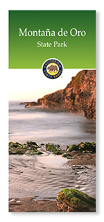
For more information about this wonderful Park see: https://www.parks.ca.gov/pages/592/files/MDO-Brochure-lr.pdf
Subscribe and receive our newsletter filled with new information and inspiring images to help you plan your next trip to the Central Coast and the Green Cottage.
We will not share your information, ever!